Reference Maps for collecting
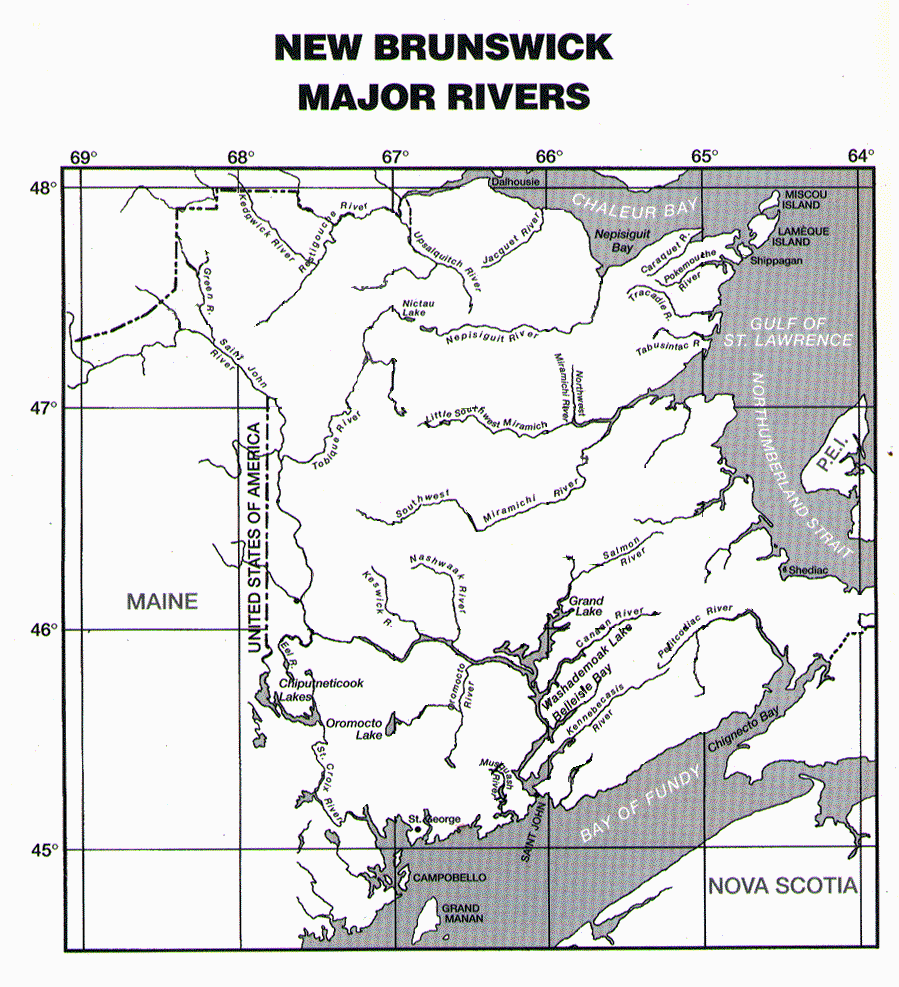
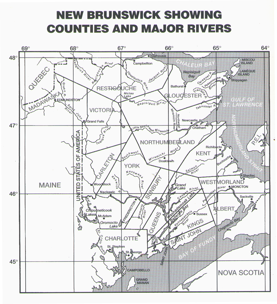
The following maps are printable, and should be used to indicate location of sampling for specimens entering the collection:
 |
New Brunswick Major Rivers |
 |
New Brunswick Counties, Major Rivers and Cities |
Related to our collections
 |
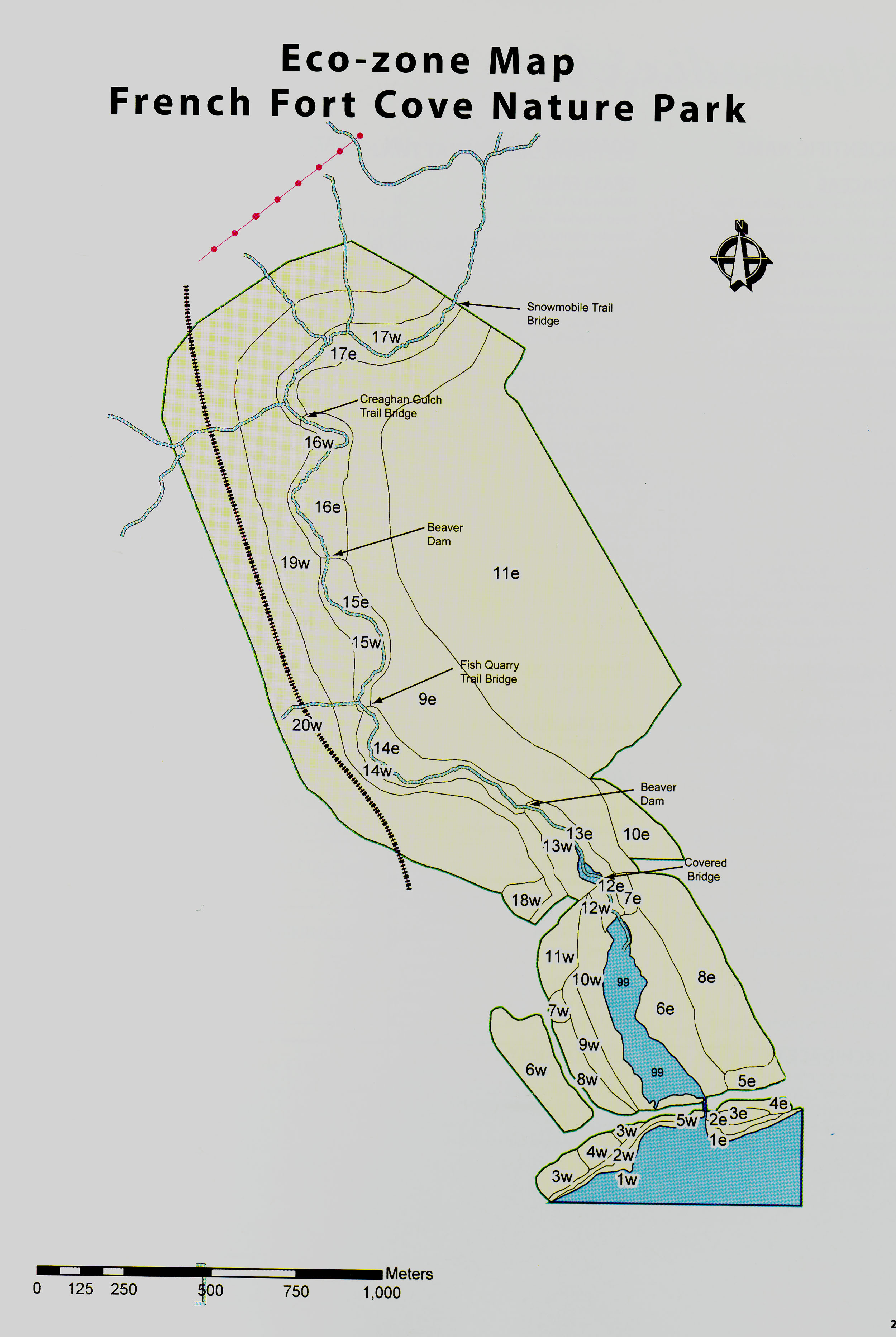
French Fort Cove Eco Zones |
 |
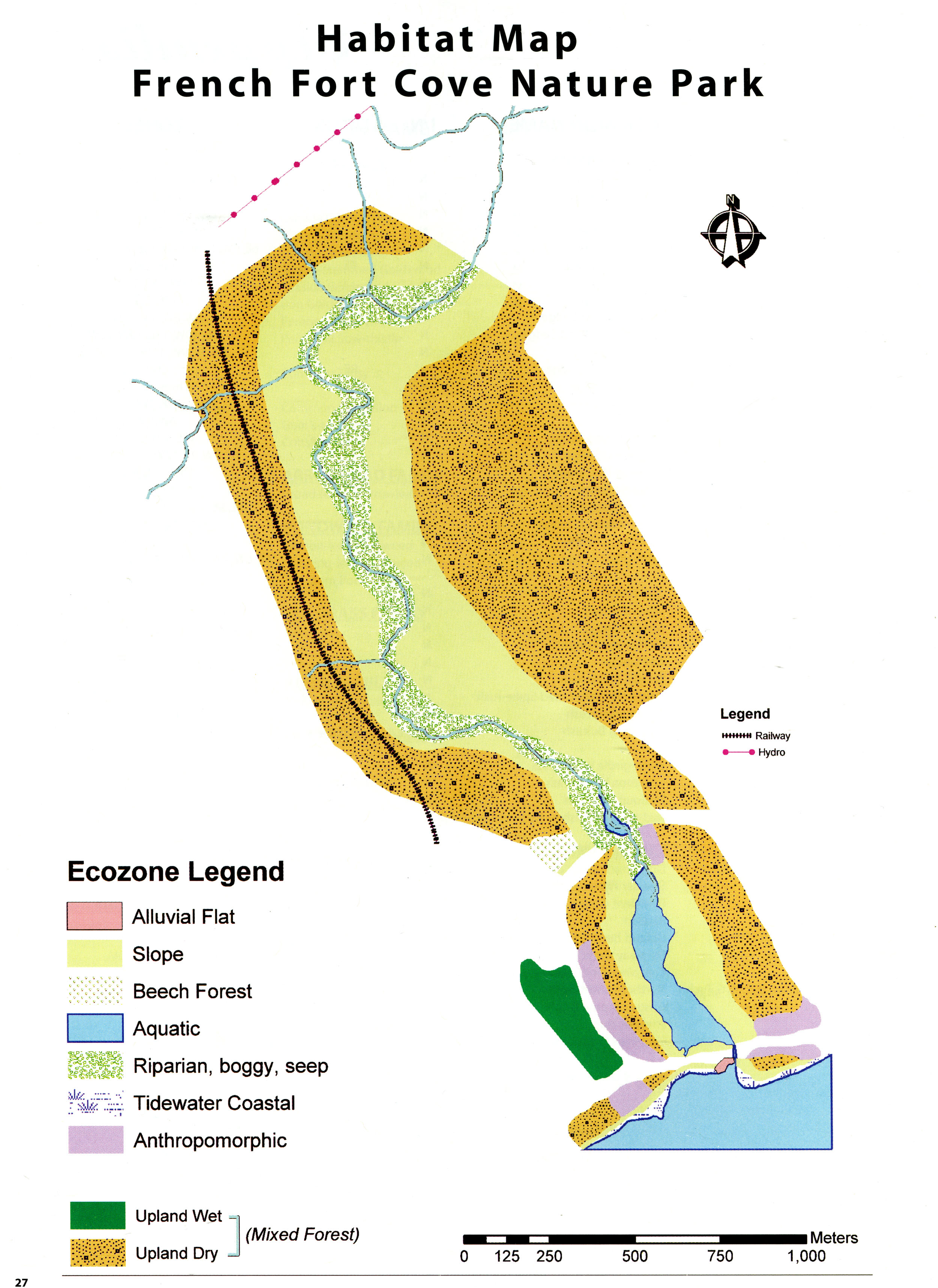
French Fort Cove Habitat |
NB County Boundary Changes
When looking at location data for the older specimens in the herbarium it should be noted that previous to 1873, the county boundaries were not the same as today. Changes are as follows:
- 1873 - Madawaska was split off from Victoria
- 1845 - Albert County was split off from Westmorland
- 1844 - Victoria was divided from Carleton
- 1837 - Restigouche was split off from Gloucester
- 1831 - Carleton was divided from York
- 1826 - Kent and Gloucester counties were split off from Northumberland. (Gloucester took in what is now Restigouche)